Imray M Series Charts Mediterranean and Aegean Seas
Imray M Series Charts Mediterranean and Aegean Seas are part of the Imray Marine M Series Charts in medium and large scales.
Imray Charts for the Mediterranean provide coverage of popular areas on sheets especially designed for the needs of yachtsmen.
These charts are printed on waterproof material and are updated by correction notices on despatch, they may also be corrected from the Imray web site.
The charts contain large-scale port insets in addition to all the small craft information that is very well known to users of Imray charts for Europe and the Caribbean.
Modifications include graduated meridians and parallels, compass rose waypoint positions, satellite-derived position offset data and the addition of land contours.
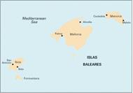
M3 - Islas Baleares, 1:350,000 - Formentera, Ibiza, Mallorca, Menorca. Plans included: San Antonio (Ibiza), Puerto de Ibiza, Puerto de Palma (Mallorca), Porto Colom (Mallorca), Puerto de Mahón (Menorca), Alcudia (Mallorca), Ciudadela (Menorca). 2010 Edition - Fully updated throughout. Includes extensive changes at Puerto de Palma and Alcudia (both Mallorca). Porto Colom (Mallorca) and Ciudadela (Menorca) plans redrawn to improve detail & positional accuracy
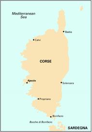
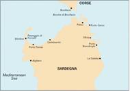
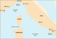
M6 - Ile de Corse, 1:255,000 - Plans included: Macinaggio, Bastia, Approaches to Calvi, Ajaccio, Approaches to Propriano, Bonifacio, Îles Lavezzi. 2012 Edition - Fully updated throughout. Includes details of the harbour developments at Ajaccio
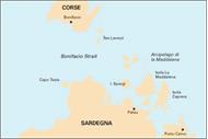
M7 - Bonifacio Strait, 1:65,000 - Large scale coverage of the Bonifacio Strait between Corsica and Sardinia with large scale inset of Maddalena. This chart overlaps M6 Corsica and M8 Sardegna (North)
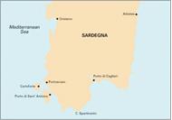
M8 - North Sardegna, 1:255,000 - Plans included: La Maddalena Archipelago - Southern Group (inc. approaches to Cervo), Golfo di Cugnana, Golfo Spurlatta, Passaggio dei Fornelli, Porto Torres, Approaches to Alghero. 2009 Edition - Now digitally drawn for improved clarity and enhanced definition. Extensive rescheming of inset plans from last edition
M9 - South Sardegna, 1:255,000 - Plans included: Approaches to Arbatax, Canale di San Pietro, Approaches to Torre Grande, Porto di Cagliari, Capo Carbonara, Golfo di Teulada. 2012 Edition - Fully updated throughout. Various marina and harbour developments are shown at Porto di Cagliari, Porto Vesme, Calasetta and Villasimius. The Golfo di Teulada plan has also been corrected for a better WGS84-positional fit
M10 - Western Mediterranean, 1:2,750,000 - Gibraltar to the Ionian Sea. 2011 Edition - Fully updated and modernised throughout
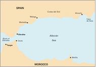
M11 - Gibraltar to Cabo de Gata & Morocco, 1:440,000 - Plans included: Strait of Gibraltar, Gibraltar, Estepona, Puerto de Almerimar, Almería, Ceuta. 2009 Edition - Extensive changes applied to Strait of Gibraltar, Gibraltar and Almería plans
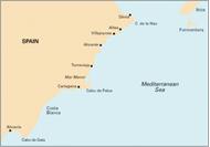
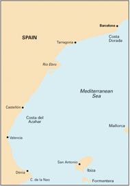
M12 - Cabo de Gata to Denia & Ibiza, 1:500,000 - Plans: Mar Menor, Torrevieja, Alicante, Approaches to Villajoyosa, Altea, Denia. 2008 Edition - Extensive changes applied to Denia and Torrevieja plans. Alicante, Villajoyosa & Altea plans reschemed to show approaches
M13 - Dénia to Barcelona and Ibiza, 1:440,000 - Plans included: Dénia, Valencia Harbour, Tarragona, Barcelona Harbour, San Antonio (Ibiza). 2010 Edition - Updated throughout. Includes extensive changes to Dénia, Valencia, Tarragona & Barcelona plans
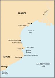
M14 - Barcelona to Bouches du Rhône, 1:440,000 - Plans included: St-Cyprien-Plage, Puerto de l'Escala, Sète, Cap d'Agde, Roses, Palamós, Port Vendres, Barcelona Harbour, Barcelona Port Vell, Puerto Olimpico. 2010 Edition - Fully updated throughout. Developments at Barcelona Harbour have been updated and the main Barcelona plan extended to show more approaches. A new Puerto Olimpico plan has been added and the Palamós plan has been redrawn for greater WGS 84 positional accuracy
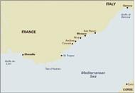
M15 - Marseille to San Remo, 1:325,000 - Plans included: Marseille Vieux-Port & Iles du Frioul, Iles d’Hyères, Golfe de St-Tropez, Golfe de La Napoule, Antibes, Nice, Rade de Villefranche & Cap Ferrat, Monaco. 2012 Edition - The chart has been radically reschemed on this edition to focus solely on the French Mediterranean coast from Marseille eastwards. The new chart is now at a larger-scale of 1:325,000 and includes a complete new set of plans (as listed above)
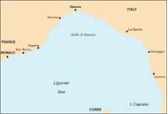
M16 - Ligurian Sea, 1:325,000 - Italy - West Coast. Plans included: San Remo, Approaches to Genoa, Golfo Marconi, Approaches to La Spezia, Viareggio, Approaches to Livorno, Livorno
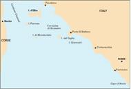
M17 - North Tuscan Islands to Rome, 1:325,000 - Italy - West Coast. Plans included: Scarlino to Punta Ala, Approaches to Giglio Marina, Approaches to Civitavecchia, Approaches to Fiumicino and Fiuma Grande, Approaches to Anzio
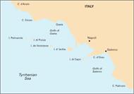
M18 - Capo d'Anzio to Capo Palinuro, 1:325,000 - Plans included: Rada di Gaeta, Golfo di Pozzuoli & Rada di Napoli, Approaches to Acciaroli, Capo Palinuro
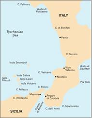
M19 - Capo Palinuro to Punta Stilo, 1:325,000 - Includes plans: Golfo di Policastro, Approaches to Vibo Valentia, Isole Alicudi, Stretto di Messina
M20 - Eastern Mediterranean, 1:2,750,000 - Sardinia to Port Said and the Black Sea. 2011 Edition - Fully updated and modernised throughout
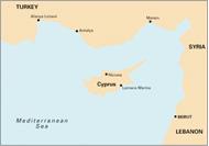
M21 - South Coast of Turkey, Syria, Lebanon & Cyprus, 1:785,000 - Passage Chart. Plans included: Alanya Limani (Turkey), Larnaca Marina (Cyprus), Mersin (Turkey). 2011 Edition - Fully updated throughout, this is the first digitally-drawn edition of this chart
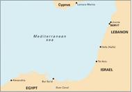
M22 - Egypt to Israel, Lebanon and Cyprus, 1:785,000 - Passage Chart. Plans included: Larnaca Marina (Cyprus), Jounie (Lebanon), Hefa (Haifa) (Israel), Bur Sa'id (Port Said) (Egypt). 2011 Edition - Fully updated throughout, this is the first digitally drawn edition of this chart
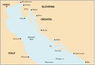
M23 - Adriatic Sea Passage Chart, 1:750,000 - Golfo di Trieste to Bar & Promontorio del Gargano. 2008 Edition - Fully updated to compliment the new Adriatic range (charts M24, M25, M26, M27)
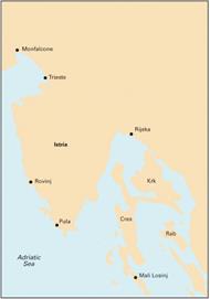
M24 - Golfo di Trieste to Losinj & Rab, 1:220,000 - Plans Rovinj, Brijuni Otoci to Pula, Veruda to Medulin Bay, Approaches to Punat, Approaches to Mali Losinj, Otok Ilovik Channel
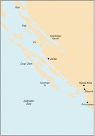
M25 - Otok Rab to Sibenik, 1:220,000 - Adriatic Sea. Plans included: Prolaz Zapuntel Passage, Passage between Otok Molat & Dugi Otok, Zadar, Luka Telascica, The Kornati Islands, Sibenik and Rijeka Krka, Prolaz Proversa Vela & Mala. 2011 Edition - Fully updated throughout, plus some plans redrawn for improved WGS84 accuracy
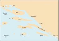
M26 - Split to Dubrovnik, 1:220,000 - Adriatic Sea. Plans included: Luka Rogoznica, Trogir Marina, Approaches to Split, The Drvenik Islands, Splitska Vrata, Approaches to Hvar & the Pakleni Islands, Approaches to Korcula, Approaches to Ubli, Approaches to Gruz & Dubrovnik Marina
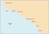
M27 - Dubrovnik to Bar & Ulcinj, 1:220,000 - Plans included: Luka Polace, The Elephite Islands, Approaches to Dubrovnik, Boka Kotorska, Approaches to Budva, Bar Marina, Ulcinj
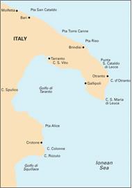
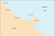
M29 - Golfo di Taranto, 1:375,000 - Includes plans: Approaches to Brindisi, Approaches to Otranto, Approaches to Gallipoli, Approaches to Crotone
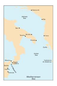
M30 - Southern Adriatic and Ionian Seas, 1:850,000 - Dubrovnik to Kérkira (Corfu) and Sicilia. Covers the area from East Sicily, the Strait of Messina and southern Italy to Corfu and north to Dubrovnik. This important passage chart links M23 Adriatic Sea with the Imray-Tetra charts for Greece. The first of a new series on Italy. Plans included: Approaches to Brindisi, Approaches to Siracusa
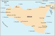
M31 - Sicily, 1:400,000 - Includes plans: Approaches to Marsala, Approaches to Favignana, Approaches to Trapani, Approaches to Palermo
M32 - Adriatic Italy (South), 1:325,000 - Pescara to Bari. Plans included: Porto di Ortona, Porto di Punta Penna (Vasto), Termoli Marina di San Pietro, Isole Tremiti, Porto di Vieste, Porto di Trani. Bari Porto Nuovo Coverage of the East Coast of Italy between Pescara and Bari. Includes large scale insets of key marinas along the Italian coast and of the Tremiti Islands
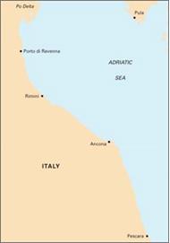
M33 - Adriatic Italy - North - Plans: Ravenna coast, Porto di Rimini, Ancona Coast, Porto di Ancona, Marina di Pescara
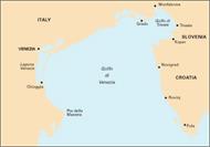
M34 - Golfo di Venezia, 1:220 000 - Plans included: Chioggia, Venezia, Approaches to Grado, Monfalcone, Trieste
M40 - Ligurian and Tyrrhenian Seas, 1:950,000 - Plans included: Monte Argentario, Bonifacio Strait, Golfo di Salerno
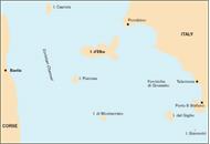
M45 - Tuscan Archipelago, 1:180,000 - Italy - West Coast. Plans Included: Approaches to Porto Capraia, Approaches to Portoferraio, Bastia, Talamone, Approaches to Porto S.Stefano
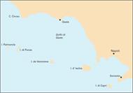
M46 - Isole Pontine to the Bay of Naples, 1:180,000 - Plans included: Approaches to Ponza, Approaches to Porto d'Ischia, Approaches to Sorrento, Approaches to Marina Grande (Capri)
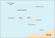
M47 - Aeolian Islands, 1:140,000 - Includes plans: Approaches to Lipari, Bocche di Vulcano
M50 - Sardegna to Ionian Sea, 1:1,100,000 - Passage chart. Includes plan: Stretto di Messina
Imray M Series Charts Mediterranean and Aegean Seas
Imray M Series Charts Mediterranean and Aegean Seas are part of the Imray Marine M Series Charts in medium and large scales.
Imray Charts for the Mediterranean provide coverage of popular areas on sheets especially designed for the needs of yachtsmen.
These charts are printed on waterproof material and are updated by correction notices on despatch, they may also be corrected from the Imray web site.
The charts contain large-scale port insets in addition to all the small craft information that is very well known to users of Imray charts for Europe and the Caribbean.
Modifications include graduated meridians and parallels, compass rose waypoint positions, satellite-derived position offset data and the addition of land contours.
M3 - Islas Baleares, 1:350,000 - Formentera, Ibiza, Mallorca, Menorca. Plans included: San Antonio (Ibiza), Puerto de Ibiza, Puerto de Palma (Mallorca), Porto Colom (Mallorca), Puerto de Mahón (Menorca), Alcudia (Mallorca), Ciudadela (Menorca). 2010 Edition - Fully updated throughout. Includes extensive changes at Puerto de Palma and Alcudia (both Mallorca). Porto Colom (Mallorca) and Ciudadela (Menorca) plans redrawn to improve detail & positional accuracy
M6 - Ile de Corse, 1:255,000 - Plans included: Macinaggio, Bastia, Approaches to Calvi, Ajaccio, Approaches to Propriano, Bonifacio, Îles Lavezzi. 2012 Edition - Fully updated throughout. Includes details of the harbour developments at Ajaccio
M7 - Bonifacio Strait, 1:65,000 - Large scale coverage of the Bonifacio Strait between Corsica and Sardinia with large scale inset of Maddalena. This chart overlaps M6 Corsica and M8 Sardegna (North)
M8 - North Sardegna, 1:255,000 - Plans included: La Maddalena Archipelago - Southern Group (inc. approaches to Cervo), Golfo di Cugnana, Golfo Spurlatta, Passaggio dei Fornelli, Porto Torres, Approaches to Alghero. 2009 Edition - Now digitally drawn for improved clarity and enhanced definition. Extensive rescheming of inset plans from last edition
M9 - South Sardegna, 1:255,000 - Plans included: Approaches to Arbatax, Canale di San Pietro, Approaches to Torre Grande, Porto di Cagliari, Capo Carbonara, Golfo di Teulada. 2012 Edition - Fully updated throughout. Various marina and harbour developments are shown at Porto di Cagliari, Porto Vesme, Calasetta and Villasimius. The Golfo di Teulada plan has also been corrected for a better WGS84-positional fit
M10 - Western Mediterranean, 1:2,750,000 - Gibraltar to the Ionian Sea. 2011 Edition - Fully updated and modernised throughout
M11 - Gibraltar to Cabo de Gata & Morocco, 1:440,000 - Plans included: Strait of Gibraltar, Gibraltar, Estepona, Puerto de Almerimar, Almería, Ceuta. 2009 Edition - Extensive changes applied to Strait of Gibraltar, Gibraltar and Almería plans
M12 - Cabo de Gata to Denia & Ibiza, 1:500,000 - Plans: Mar Menor, Torrevieja, Alicante, Approaches to Villajoyosa, Altea, Denia. 2008 Edition - Extensive changes applied to Denia and Torrevieja plans. Alicante, Villajoyosa & Altea plans reschemed to show approaches
M13 - Dénia to Barcelona and Ibiza, 1:440,000 - Plans included: Dénia, Valencia Harbour, Tarragona, Barcelona Harbour, San Antonio (Ibiza). 2010 Edition - Updated throughout. Includes extensive changes to Dénia, Valencia, Tarragona & Barcelona plans
M14 - Barcelona to Bouches du Rhône, 1:440,000 - Plans included: St-Cyprien-Plage, Puerto de l'Escala, Sète, Cap d'Agde, Roses, Palamós, Port Vendres, Barcelona Harbour, Barcelona Port Vell, Puerto Olimpico. 2010 Edition - Fully updated throughout. Developments at Barcelona Harbour have been updated and the main Barcelona plan extended to show more approaches. A new Puerto Olimpico plan has been added and the Palamós plan has been redrawn for greater WGS 84 positional accuracy
M15 - Marseille to San Remo, 1:325,000 - Plans included: Marseille Vieux-Port & Iles du Frioul, Iles d’Hyères, Golfe de St-Tropez, Golfe de La Napoule, Antibes, Nice, Rade de Villefranche & Cap Ferrat, Monaco. 2012 Edition - The chart has been radically reschemed on this edition to focus solely on the French Mediterranean coast from Marseille eastwards. The new chart is now at a larger-scale of 1:325,000 and includes a complete new set of plans (as listed above)
M16 - Ligurian Sea, 1:325,000 - Italy - West Coast. Plans included: San Remo, Approaches to Genoa, Golfo Marconi, Approaches to La Spezia, Viareggio, Approaches to Livorno, Livorno
M17 - North Tuscan Islands to Rome, 1:325,000 - Italy - West Coast. Plans included: Scarlino to Punta Ala, Approaches to Giglio Marina, Approaches to Civitavecchia, Approaches to Fiumicino and Fiuma Grande, Approaches to Anzio
M18 - Capo d'Anzio to Capo Palinuro, 1:325,000 - Plans included: Rada di Gaeta, Golfo di Pozzuoli & Rada di Napoli, Approaches to Acciaroli, Capo Palinuro
M19 - Capo Palinuro to Punta Stilo, 1:325,000 - Includes plans: Golfo di Policastro, Approaches to Vibo Valentia, Isole Alicudi, Stretto di Messina
M20 - Eastern Mediterranean, 1:2,750,000 - Sardinia to Port Said and the Black Sea. 2011 Edition - Fully updated and modernised throughout
M21 - South Coast of Turkey, Syria, Lebanon & Cyprus, 1:785,000 - Passage Chart. Plans included: Alanya Limani (Turkey), Larnaca Marina (Cyprus), Mersin (Turkey). 2011 Edition - Fully updated throughout, this is the first digitally-drawn edition of this chart
M22 - Egypt to Israel, Lebanon and Cyprus, 1:785,000 - Passage Chart. Plans included: Larnaca Marina (Cyprus), Jounie (Lebanon), Hefa (Haifa) (Israel), Bur Sa'id (Port Said) (Egypt). 2011 Edition - Fully updated throughout, this is the first digitally drawn edition of this chart
M23 - Adriatic Sea Passage Chart, 1:750,000 - Golfo di Trieste to Bar & Promontorio del Gargano. 2008 Edition - Fully updated to compliment the new Adriatic range (charts M24, M25, M26, M27)
M24 - Golfo di Trieste to Losinj & Rab, 1:220,000 - Plans Rovinj, Brijuni Otoci to Pula, Veruda to Medulin Bay, Approaches to Punat, Approaches to Mali Losinj, Otok Ilovik Channel
M25 - Otok Rab to Sibenik, 1:220,000 - Adriatic Sea. Plans included: Prolaz Zapuntel Passage, Passage between Otok Molat & Dugi Otok, Zadar, Luka Telascica, The Kornati Islands, Sibenik and Rijeka Krka, Prolaz Proversa Vela & Mala. 2011 Edition - Fully updated throughout, plus some plans redrawn for improved WGS84 accuracy
M26 - Split to Dubrovnik, 1:220,000 - Adriatic Sea. Plans included: Luka Rogoznica, Trogir Marina, Approaches to Split, The Drvenik Islands, Splitska Vrata, Approaches to Hvar & the Pakleni Islands, Approaches to Korcula, Approaches to Ubli, Approaches to Gruz & Dubrovnik Marina
M27 - Dubrovnik to Bar & Ulcinj, 1:220,000 - Plans included: Luka Polace, The Elephite Islands, Approaches to Dubrovnik, Boka Kotorska, Approaches to Budva, Bar Marina, Ulcinj
M29 - Golfo di Taranto, 1:375,000 - Includes plans: Approaches to Brindisi, Approaches to Otranto, Approaches to Gallipoli, Approaches to Crotone
M30 - Southern Adriatic and Ionian Seas, 1:850,000 - Dubrovnik to Kérkira (Corfu) and Sicilia. Covers the area from East Sicily, the Strait of Messina and southern Italy to Corfu and north to Dubrovnik. This important passage chart links M23 Adriatic Sea with the Imray-Tetra charts for Greece. The first of a new series on Italy. Plans included: Approaches to Brindisi, Approaches to Siracusa
M31 - Sicily, 1:400,000 - Includes plans: Approaches to Marsala, Approaches to Favignana, Approaches to Trapani, Approaches to Palermo
M32 - Adriatic Italy (South), 1:325,000 - Pescara to Bari. Plans included: Porto di Ortona, Porto di Punta Penna (Vasto), Termoli Marina di San Pietro, Isole Tremiti, Porto di Vieste, Porto di Trani. Bari Porto Nuovo Coverage of the East Coast of Italy between Pescara and Bari. Includes large scale insets of key marinas along the Italian coast and of the Tremiti Islands
M33 - Adriatic Italy - North - Plans: Ravenna coast, Porto di Rimini, Ancona Coast, Porto di Ancona, Marina di Pescara
M34 - Golfo di Venezia, 1:220 000 - Plans included: Chioggia, Venezia, Approaches to Grado, Monfalcone, Trieste
M40 - Ligurian and Tyrrhenian Seas, 1:950,000 - Plans included: Monte Argentario, Bonifacio Strait, Golfo di Salerno
M45 - Tuscan Archipelago, 1:180,000 - Italy - West Coast. Plans Included: Approaches to Porto Capraia, Approaches to Portoferraio, Bastia, Talamone, Approaches to Porto S.Stefano
M46 - Isole Pontine to the Bay of Naples, 1:180,000 - Plans included: Approaches to Ponza, Approaches to Porto d'Ischia, Approaches to Sorrento, Approaches to Marina Grande (Capri)
M47 - Aeolian Islands, 1:140,000 - Includes plans: Approaches to Lipari, Bocche di Vulcano
M50 - Sardegna to Ionian Sea, 1:1,100,000 - Passage chart. Includes plan: Stretto di Messina
We use cookies and similar tools that are necessary to enable you to make purchases, to enhance your shopping experiences and to provide our services, as detailed in our Cookie Policy. We also use these cookies to understand how customers use our services (for example, by measuring site visits) so we can make improvements.
If you agree, we’ll also use cookies to complement your shopping experience as described in our Cookie Policy. This includes using first- and third-party cookies, which store or access standard device information such as a unique identifier. Third parties use cookies for their purposes of displaying and measuring personalised ads, generating audience insights, and developing and improving products. Carry on browsing if you’re happy with our Cookie Policy, or find out how to manage your cookies. To learn more about how and for what purposes we use personal information, please visit our Privacy Notice.

 Imray M Series Charts Mediterranean and Aegean Seas
