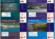
Imray 2000 Series - Chart Packs in small format are an impressive and increasingly popular series of charts designed for use in open pockets and on chart tables in what may well be very confined spaces onboard a boat.
This range of handy-sized charts is being extended and is published as sets and individual sheets. Intended especially for yachtsmen, these charts are edited to exclude unnecessary data that is so often included in other series and which only serve to make finding the important information more difficult to identify.
Imray 2000 Series - Chart Packs are printed in colour on waterproof paper and they are correctable.
Features
Sets of charts in a plastic wallet
Available as single sheets flat or folded to A4
Small format A2 size sheets - 594 x 420 mm
Waterproof paper
Corrected to date of issue with free updating service thereafter
All WGS 84 datum
2000 Suffolk and Essex Coasts Chart Pack
2000.1: Suffolk and Essex Coasts, 1:120,000 - 2010 Edition - Fully updated throughout. Shows revised depths (especially in King's Channel, Fisherman's Gat & Long Sand Head), plus the latest windfarm developments
2000.2: Rivers Ore and Alde, 1:35,000 - 2011 Edition - Includes detail of the revised entry to Orford Haven based upon 2011 survey data
2000.3 - River Deben and Orford Haven, 1:35,000 - Plans included: Woodbridge, Tide Mill Yacht Harbour. 2011 Edition - Includes detail of the revised entry to Orford and Woodbridge Havens based upon 2011 survey data
2000.4 - Harwich Approaches and Walton Backwaters, 1:35,000 - Includes plan of Walton Yacht Basin and Titchmarsh Marina. 2010 Edition - includes the latest survey data, plus details of the ongoing works at Felixstowe
2000.5 - Rivers Stour and Orwell, 1:35,000 - Plans included: Upper Orwell to Ipswich, Fox's Marina, Woolverstone Marina, Suffolk Yacht Harbour, Shotley Marina. 2011 Edition - Shows the latest depths and harbour developments at Felixstowe
2000.6 - River Blackwater, 1:35,000 - Plans included: Maldon, Tollesbury Yacht Harbour, Bradwell Marina. 2011 Edition - Shows revised buoyage in Mersea Quarters and the approaches to Tollesbury and Bradwell Marina. The latest available survey data is used throughout, particularly in the Tollesbury channels and Bradwell Creek
2000.7 - River Colne, 1:35,000 - Plans included: Wivenhoe, Brightlingsea. 2011 EDITION - Shows revised buoyage in Mersea Quarters and the approaches to Tollesbury, plus detail of Waterside Marina at Brightlingsea. The latest available survey data is used throughout, particularly in the Tollesbury channel and at Bradwell.
2000.8 - River Crouch Entrance, 1:35,000 - 2011 Edition - Shows the revised buoyage into the River Crouch, plus uses the latest available survey data throughout
2000.9 - Rivers Crouch and Roach, 1:35,000 - Plans included: Fambridge Yacht Haven, Bridgemarsh Marina, Burnham Yacht Harbour, Continuation of the River Crouch. 2011 Edition - Shows the revised buoyage into the River Crouch, plus uses the latest available survey data throughout
2000.10 - Orford Ness to Lowestoft, 1:90,000 - Plans included: Lowestoft Approaches, Lowestoft Harbour, Lowestoft - Lake Lothing, Southwold Harbour. 2011 Edition - Shows the latest depth surveys in Lowestoft Harbour and approaches. Please note this chart is only available flat not folded
2100 Kent Coast Chart Pack
2100.1 - Thames Estuary South, 1:120,000 - 2011 Edition - Fully updated throughout. Shows revised depths (especially in Princes Channel & Fisherman's Gat), plus the latest windfarm developments
2100.2 - River Thames Sea Reach, 1:40,000 - 2012 Edition - Fully updated throughout using the latest available depth surveys
2100.3 - River Medway, 1:40,000 - Plans included: Gillingham Marina, Hoo Marina, Whitton Marine, Continuation of River Medway. 2012 Edition - Fully updated throughout using the latest available depth surveys
2100.4 - The Swale, 1:40,000 - Plans included: Whitstable Harbour. 2012 Edition - Fully updated throughout using the latest available depth surveys
2100.5 - North Foreland to Dover, 1:120,000 - Includes plan of Ramsgate. 2010 Edition - Includes depth changes in Ramsgate Harbour and approaches, and Goodwin Sands.
2100.6 - Dover Strait, 1:200,000 - Plans included: Rade de Dunkerque. 2012 Edition - Fully updated throughout using the latest available depth surveys
2100.7 - Dover to Beachy Head and Boulogne, 1:175,000 - Plans: Dover, Sovereign Harbour. Please note this chart is only available flat not folded
2100.8 - Beachy Head to Nab Tower, 1:160,000 - Plans: Littlehampton, Brighton Marina, Newhaven. Please note this chart is only available flat not folded
2200 The Solent Chart Pack
2200.1 - Isle of Wight, 1:100,000
2200.2 - Christchurch to the Solent, 1:60,000 - Plans included: Lymington River, Christchurch. 2012 Edition - Fully updated throughout using the latest known depths. Full details of the harbour changes in the Lymington River are shown. Please note this chart is only available flat and not folded
2200.3 - Eastern Approaches to the Solent, 1:60,000 - 2011 edition - Fully updated throughout, including the latest depth surveys
2200.4 - Chichester and Langstone Harbours, 1:35,000 - Plans included: Southsea Marina, Northney Marina, Emsworth Yacht Harbour, Sparkes Yacht Harbour, Chichester and Birdham Marina. 2012 Edition - Fully updated. Includes depths from the latest available survey data, particularly in the approach channel to Chichester Harbour
2200.5 - Portsmouth Harbour and Approaches, 1:22,500
2200.6 - Central Solent, 1:35,000
2200.7 - Southampton Water, 1:35,000 - Inset: Continuation to Southampton Water
2200.8 - West Solent, 1:35,000 - Plan: Yarmouth Harbour
2200.9 - Isle of Wight and Solent Plans, Various scales - A double-sided sheet of plans including: Bembridge Harbour & Approaches, Newtown River, Cowes & River Medina, Wootton Creek, Ryde, Beaulieu River, Keyhaven. 2012 Edition - Fully updated throughout, including the latest known depths. Harbour developments in the River Medina, including the new small craft channel, are shown. Please note this chart is only available flat not folded
2200.10 - Rivers & Marinas in Southampton Water, Various scales, double sided sheet - A double sided sheet of plans including: Entrance to River Hamble, River Hamble - Continuation to Burlesdon, River Itchen & Approaches. New sheet for 2011 - Added to 2200 series to provide larger-scale coverage of the rivers and marinas around Southampton.Please note this chart is only available flat not folded
2300 Dorset and Devon Coasts Chart Pack
2300.1 - Isle of Wight to Start Point, 1:400,000 - Please note this chart is only available flat
2300.2 - Western Approaches to the Solent, 1:60,000 - 2010 Edition - Fully updated. Tidal data added to chart. Please note this chart is only available flat
2300.3 - Poole Harbour to Bill of Portland, 1:75,000 - Includes plans: Weymouth Harbour, Lulworth Cove, Worbarrow Bay, Swanage Bay, Portland Harbour. 2011 Edition - Fully updated with the latest available depths used throughout. This sheet has now been expanded to a double-sided sheet with plans of Warbarrow Bay, Swanage Bay and Portland Harbour added to the coverage. Please note this chart is only available flat
2300.4 - Lyme Bay, 1:175,000 - Plans: Lyme Regis, Bridport Harbour. Please note only available flat not folded
2300.5 - Poole Harbour, 1:20,000 - Double-sided sheet for Poole Harbour. Plans: Holes Bay, Salterns Marina, Moriconium Quay & Lake Yard Marina, Continuation to Studland Bay. Please note only available flat not folded
2300.6 - River Exe, 1:21,500 - Plans included: Continuation of River Exe to Exeter, Exmouth Dock. 2010 Edition - Shows the latest survey data in the approach and entrance to the River Exe
2300.7 - Exmouth to Salcombe, 1:100,000
2300.8 - Teignmouth and Tor Bay, 1:55,000 - Plans: Brixham, Torquay, Paignton, Teignmouth. 2008 Edition - Includes extensive changes to depths in Torquay Harbour, plus details fully updated for the 2300 chart pack
2300.9 - River Dart, 1:15,000 - Plans: Continuation to Totnes, Kingswear. 2008 Edition - Details fully updated for the 2300 chart pack
2400 West Country Chart Pack
2400.1 - Land's End to Trevose Head, 1:180,000 - Plans included: Newquay Bay, St Ives. 2009 Edition - includes revised TSS, plus latest depths & changes to lights & wrecks. Please note only available flat not folded
2400.2 - Approaches to the Isles of Scilly, 1:120,000 - 2009 Edition - includes revised TSS details, plus latest depths & changes to lights & wrecks. Please note this chart is only available flat not folded
2400.3 - Isles of Scilly, 1:40,000 - Plan: St Marys Road. Please note only available flat not folded
2400.4 - River Camel, 1:30,000 - Plan: Padstow Harbour. Please note only available flat not folded
2400.5 - Salcombe, 1:15,000 - Small format A2 chart. 2011 Edition - Shows revised depths on The Bar and changes to buoyage in the approaches to Salcombe
2400.6 - River Yealm, 1:12,500 - Includes inset of Continuation of River Yealm. 2010 Edition - updated using the latest survey data
2400.7 - River Fowey to Lostwithiel, 1:9,000 - Inset: Continuation to Lostwithiel
2400.8 - Start Point to Fowey, 1:150,000
2400.9 - Fowey to Lizard point, 1:110,000 - Plan: Mevagissey Habour
2400.10 - Lizard Point to Land's End, 1:75,000 - Chart covering Lizard Point to Land's End
2400.11 - Helford River, 1:17,000 - Inset: Continuation of Helford River to Gweek
2400.13 - Plymouth Harbour, 1:20,000 - Plans included: Plymouth Yacht Haven, Mayflower Marina, Sutton Harbour and Queen Anne's Battery Marina. 2009 Edition - includes changes to depths and dredged areas from the latest available surveys
2400.14 - Saint Mary's, Tresco and surrounding islands, 1:20,000 - New chart for 2010. Please note only available flat not folded
2500 Channel Islands Chart Pack
2500.1 - Alderney to Iles Chausey, 1:220,000 - Overview chart of the Channel Islands
2500.2 - Alderney to Guernsey, 1:80,000 - Plans: Alderney Harbour to Long Bay, Beaucette Marina, St Peter Port
2500.3 - Guernsey, Herm and Jethou, 1:50,000 - Plan of Herm Harbour & Rosiere Anchorage
2500.4 - Guernsey to Jersey, 1:100,000 - Plans: La Maseline & Creux Harbour, Havre Gosselin, Little Sark, La Corbiere Boat Passage, St Helier Harbour
2500.5 - Jersey (St Helier) to Carteret, 1:85,000 - Plans: Les Ecrehou, Gorey Harbour, Brett Boat Channel & Violet Channel
2500.6 - Alderney to Jersey, 1:120,000 - Plans: St Catherine's Bay and Dielette
2500.7 - Jersey to Granville, 1:120,000 - Plans: Maitresse Ile, Sound of Chausey, Granville
2500.8 - St Malo Approaches, 1:120,000 - Plan St-Malo Please note this chart is only available flat not folded. Please note this chart is only available flat not folded
2500.9 - East Guernsey, Helm and Sark, 1:42,000 - Includes plan of Beaucette Marina. Please note this chart is only available flat not folded
2500.10 - Approaches to the Channel Islands, 1:400,000 - Approaches to the Channel Islands from the South coast of England. Please note this chart is only available flat not folded
2600 Bristol Channel Chart Pack
2600.1 - Trevose Head to St David's Head, 1:450,000 - The Bristol Channel. Please note this chart is only available flat not folded
2600.2 - Padstow to Hartland Point, 1:120,000 - The Bristol Channel. Plans: Approaches to Padstow and Bude Haven. Please note this chart is only available flat not folded
2600.3 - Hartland to Ilfracombe, 1:140,000 - The Bristol Channel. Plans Barnstable to Bideford & Continuation to Barnstable. Scale 1:50,000. Lundy. Scale 1:50,000. Please note this chart is only available flat not folded
2600.4 - Approaches to the Bristol Channel, 1:130,000 - Please note this chart is only available flat not folded
2600.5 - Ilfracombe to Nash Point, 1:130,000 - Plans: The Mumbles, Swansea Marina, Porthcawl, Ilfracombe. Please note this chart is only available flat not folded
2600.6 - Nash Point to Flat Holm, 1:80,000 - Plan: Watchet. Please note this chart is only available flat not folded
2600.7 - Flat Holm to Avonmouth, 1:70,000 - Includes plan of Cardiff Bay. 2011 Edition - Shows latest available depths, plus amendments to pontoons, small craft facilities & jetties on Cardiff Bay plan. Please note this chart is only available flat not folded
2600.8 - River Severn to Sharpness, 1:50,000 - Plan: Sharpness (1:15,000). Please note this chart is only available flat not folded
2600.9 - River Avon, 1:20,000 - 2011 Edition - Shows the latest depths throughout. Please note this chart is only available flat not folded
2600.10 - Tenby to Skomer Island, 1:135,000 - Plans: Jack Sound, Tenby & Caldey Island. Please note this chart is only available flat not folded
2600.11 - Milford Haven and River Cleddau, Various scales - A new double-sided chart with Milford Haven below Neyland Bridge at a scale of 1:30,000 on the front, and on the reverse the River Cleddau above Neyland Point to Haverfordwest with tributaries at a scale of 1:25 0000. There are plan insets of Milford Marina, Neyland Yacht Haven, Continuation to Haverfordwest. This attractively packaged, small format (A2), waterproof chart replaces C13 Milford Haven.
2700 North and West Wales Chart Pack
2700.1 - Liverpool Bay and Anglesey, 1:280,000 - North and West Wales. Includes plan of Holyhead. Please note this chart is only available flat not folded
2700.2 - Anglesey to Menai, 1:145,000 - North and West Wales. Plans included: Conwy Bay, Conwy. Please note this chart is only available flat not folded
2700.3 - Southern Anglesey and Lleyn Peninsula, 1:145,000 - North and West Wales. Includes plan of Porth Dinlläen. Please note this chart is only available flat not folded
2700.4 - Anglesey to Fishguard, 1:280,000 - North and West Wales. Please note this chart is only available flat not folded
2700.5 - Cardigan Bay, 1:145,000 - North & West Wales. Please note this chart is only available flat not folded
2700.6 - Aberaeron to St David's, 1:155,000 - North & West Wales. Please note this chart is only available flat not folded
2700.7 - St George's Channel, 1:280,000 - North and West Wales. Includes plan of Kilmore Quay. Please note this chart is only available flat not folded
2700.8 - Menai Strait and The Swellies, 1:70,000 - North and West Wales. Plans included: Bangor and Beaumaris, The Swellies, Port Dinorwic, Caernarfon, Llanddwyn Island. Please note this chart is only available flat not folded
2700.9 - Cardigan Bay Plans, Various Scales - North & West Coast. Double-sided sheet, consisting of numerous harbour plans: Abersoch 1:25,000, Pwllheli 1:12,500, Porthmadog 1:10,000, Mochras Lagoon 1:15,000, Barmouth 1:25,000, Aberdovey 1:25,000, Aberystwyth 1:18,000, Aberaeron 1:17,500, New Quay 1:20,000, Aberporth 1:30,000, Cardigan 1:40,000, Newport Bay 1:35,000, Fishguard 1:18,000. Please note this chart is only available flat not folded
2700.10 - Tremadoc Bay, 1:80,000 - North and West Wales. Please note this chart is only available flat not folded
2800 The West Coast of Scotland Chart Pack
2800.1 - Crinan to Tobermory and Fort William, 1:160,000
2800.2 - Loch Crinan to Garbh Eileach, 1:50,000 - Plans: Craobh Haven, Crinan Basin. Inset: Continuation of Loch Melfort
2800.3 - Cuan Sound to Loch Spelve and Kerrera Sound, 1:50,000 - Plans: Oban, Loch Feochan Entrance, Cuan Sound. Inset: Continuation of Loch Spelve
2800.4 - Oban to Loch Aline and Port Appin, 1:50,000 - Plans: Dunstaffnage Bay, Onan
2800.5 - Loch Aline to Tobermory and Loch Sunart, 1:50,000 - Plan: Tobermory
2800.6 - Loch Linnhe - South and Loch Creran, 1:50,000 - Inset: Continuation of Loch Etive
2800.7 - Loch Linnhe - North and Loch Leven, 1:50,000 - Plans: Corpach Sea Lock, Corran Narrows, Loch Leven Narrows
2900 Upper Clyde Chart Pack
2900.1 - The Upper Firth of Clyde and Loch Fyne, 1:130,000
2900.2 - Loch Fyne - Ardrishaig to Inveraray, 1:50,000 - Plans: Ardrishaig Marina, Continuation of Upper Loch Fyne
2900.3 - Lower Loch Fyne and Inchmarnock Water, 1:50,000 - Plans: East Loch Tarbert, Loch Ranza, Burnt Islands, Continuation of Loch Riddon
We use cookies and similar tools that are necessary to enable you to make purchases, to enhance your shopping experiences and to provide our services, as detailed in our Cookie Policy. We also use these cookies to understand how customers use our services (for example, by measuring site visits) so we can make improvements.
If you agree, we’ll also use cookies to complement your shopping experience as described in our Cookie Policy. This includes using first- and third-party cookies, which store or access standard device information such as a unique identifier. Third parties use cookies for their purposes of displaying and measuring personalised ads, generating audience insights, and developing and improving products. Carry on browsing if you’re happy with our Cookie Policy, or find out how to manage your cookies. To learn more about how and for what purposes we use personal information, please visit our Privacy Notice.

 Imray 2000 Series - Chart Packs
